Geo + Relay
Spatial data, visualized.
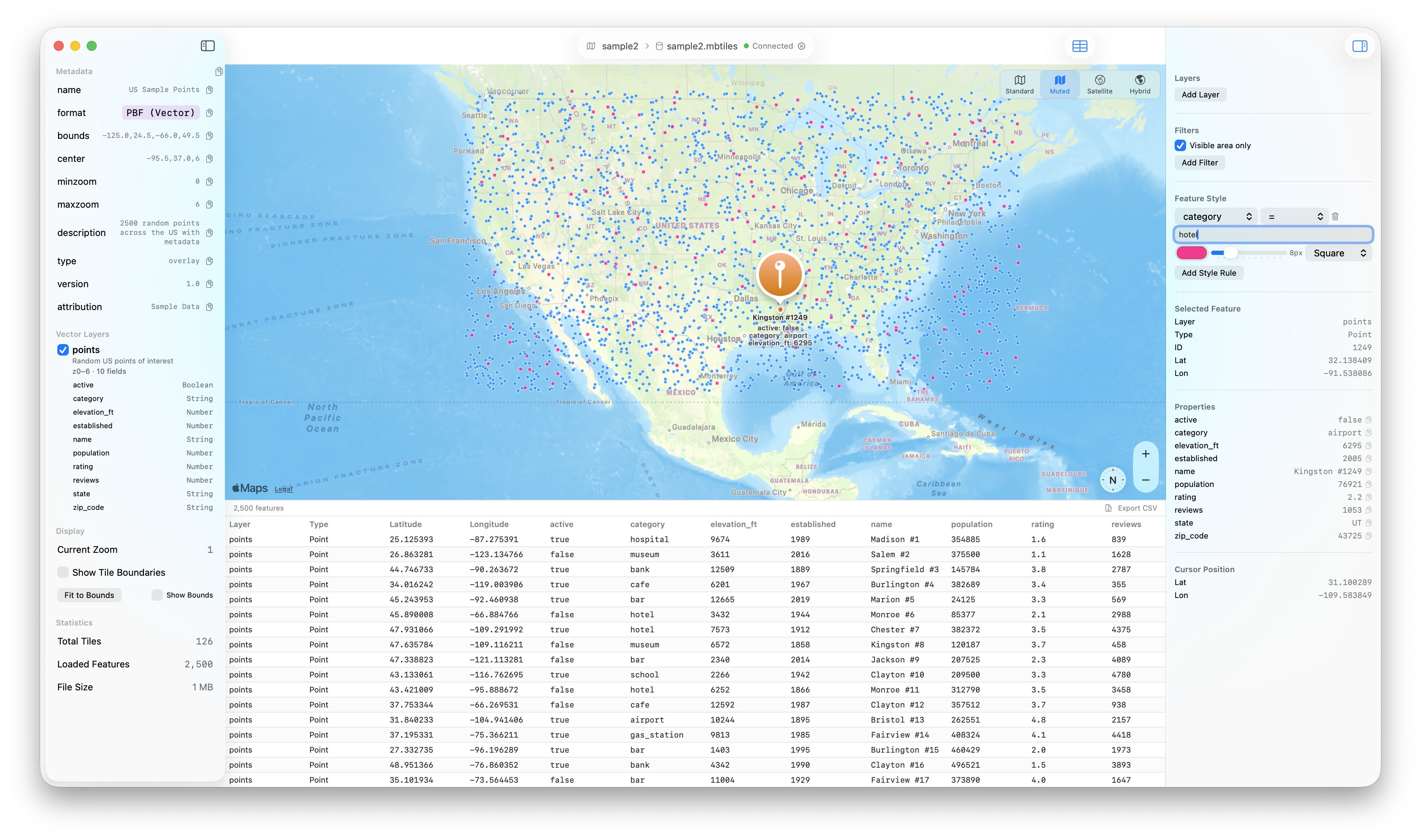
Open MBTiles files, browse raster and vector tiles on an interactive map, filter and style features, and inspect spatial data — all from a native macOS app.
Everything you need for Geo
Relay gives you a complete toolkit for working with Geo — no plugins, no extensions, just a native app that works.
Interactive Map
Visualize tiles on a full MapKit-powered map with pan, zoom, and multiple styles — Standard, Muted, Satellite, and Hybrid.
Vector Tile Decoding
Decode and render Mapbox Vector Tiles (PBF) with support for points, lines, polygons, and all MVT geometry types.
Feature Filtering
Filter vector features by property fields with operators like equals, not equals, greater than, less than, and contains.
Data-Driven Styling
Style features by property values with custom colors, sizes, and shapes — circles, squares, and triangles — applied per rule.
External Tile Layers
Add TMS tile layers from any URL template with custom HTTP headers, opacity control, and zoom range configuration.
Data Table & Export
Browse loaded vector features in a sortable table view with property columns, row selection synced to the map, and CSV export.
Native Performance
Built with Swift and SwiftUI for instant startup, low memory, and smooth scrolling on macOS.